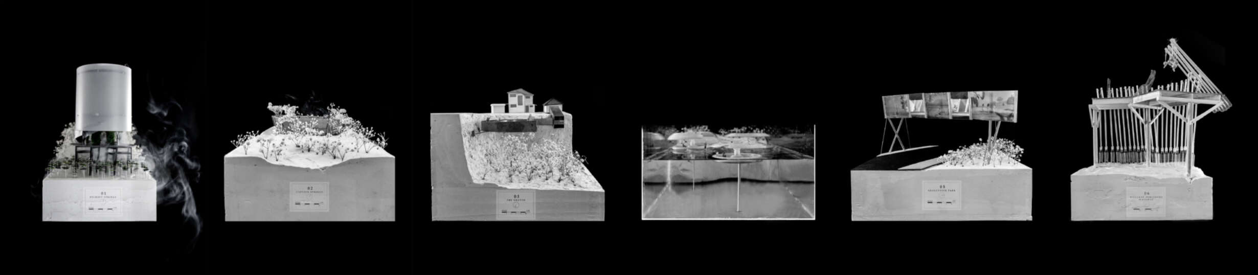
Finding the Mauri: Reconnecting Onehunga’s aquifers and subterranean landscape to cultural narratives

Page Header Image
1700 Section of Bycroft Springs Onehunga

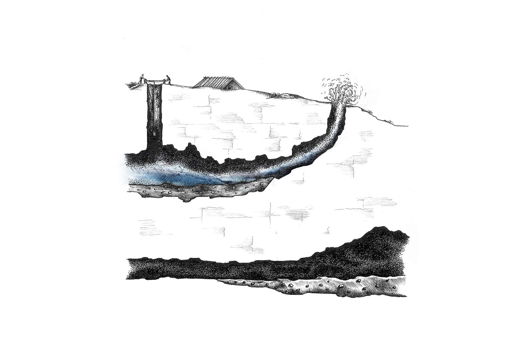
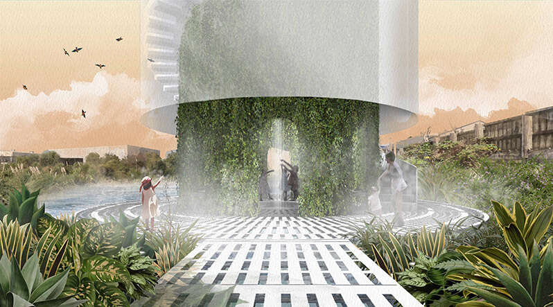
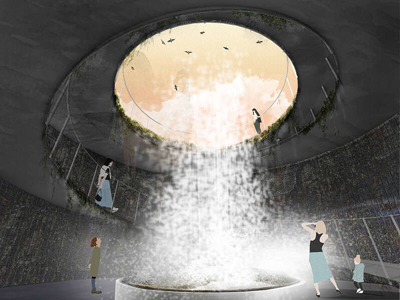
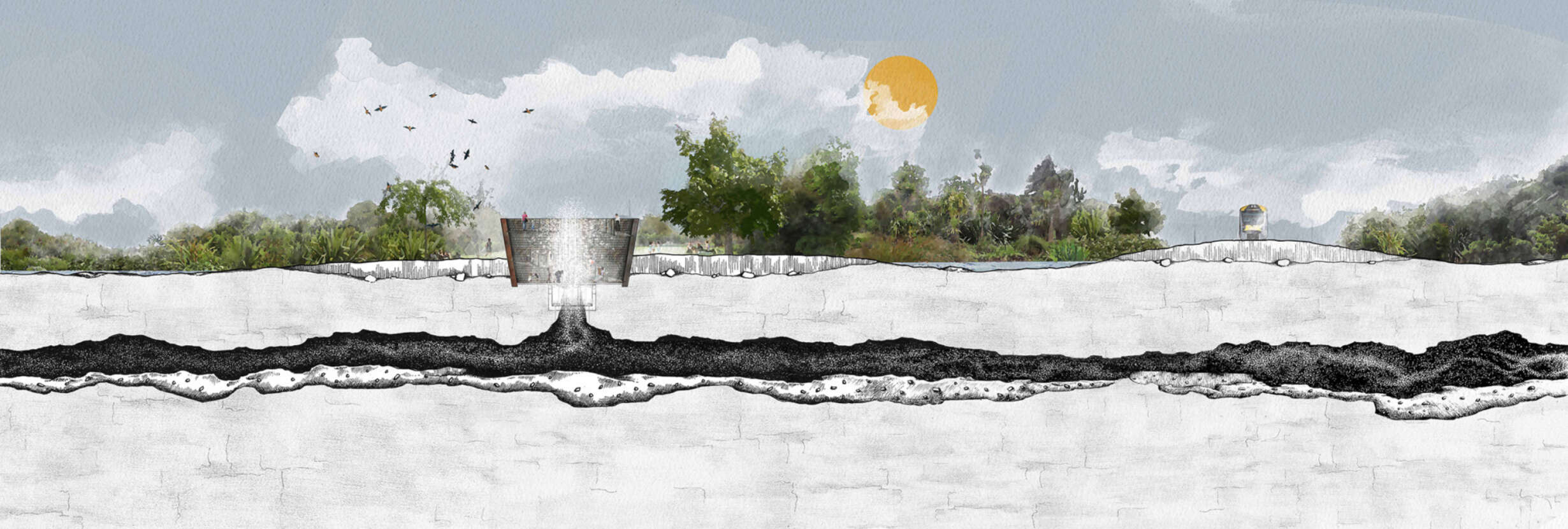
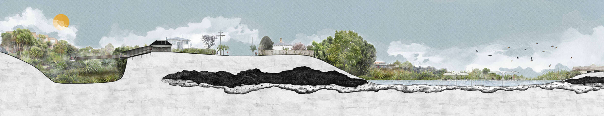
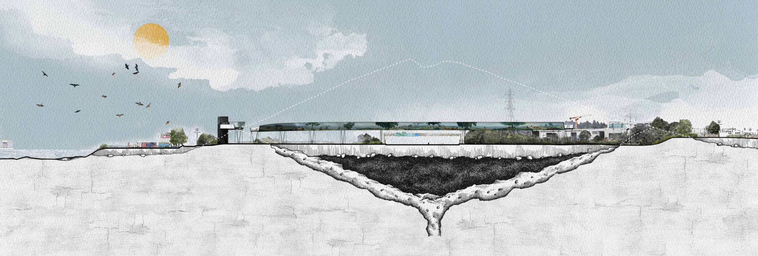
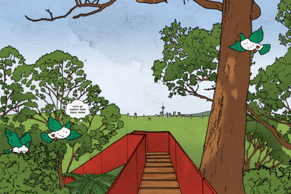
Onehunga began on the shoreline of the Manukau Harbour at a place where bubbling springs formed freshwater pools in the fertile volcanic soils of the Maungakiekie volcanic field. Māori called this place ‘one unga’ - 'landing beach'. It was the largest Māori papakāinga (settlement) in the district, the gardens thriving with fresh produce, the shore lined with canoes and a constant supply of clean spring water that seeped through the aquifers from Maungakiekie (One Tree Hill) and Rarotonga (Mt Smart).


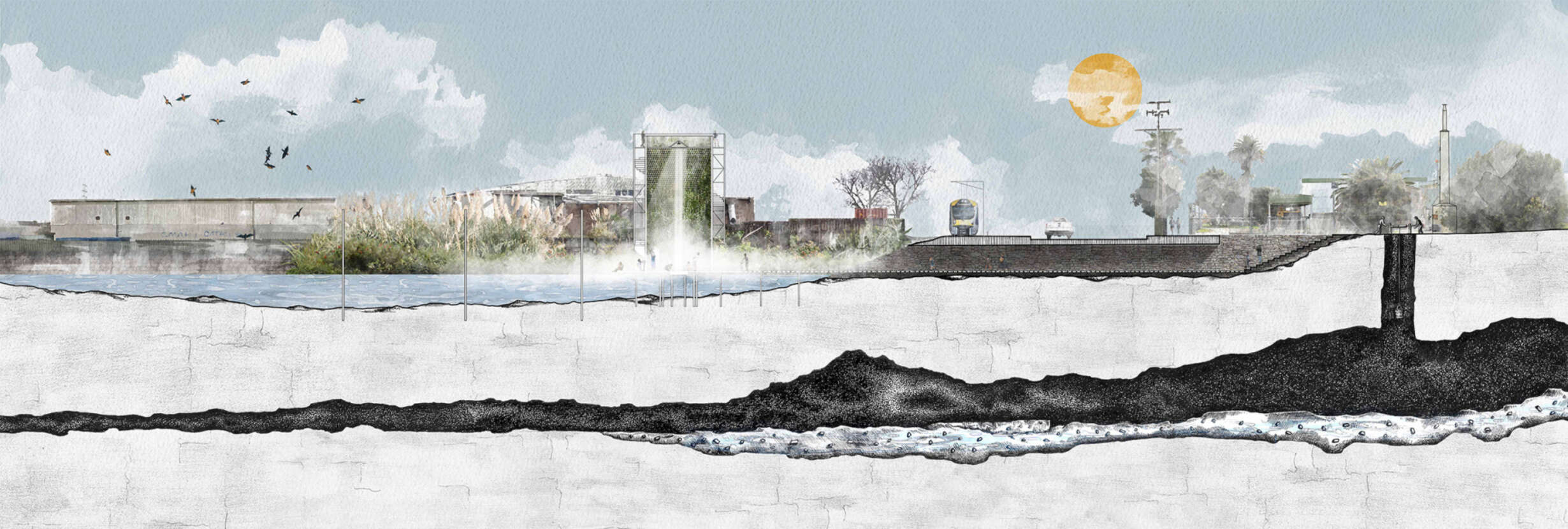
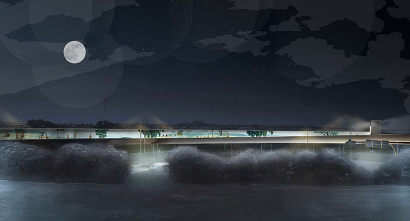
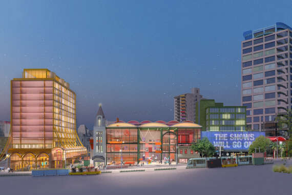
Today, Onehunga shoreline is an industrial estate, asphalt and concrete covering its old gardens. Where children once played - trucks, buses, diggers and forklifts now scurry about.

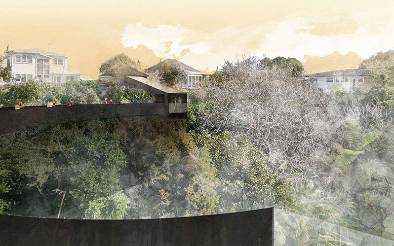
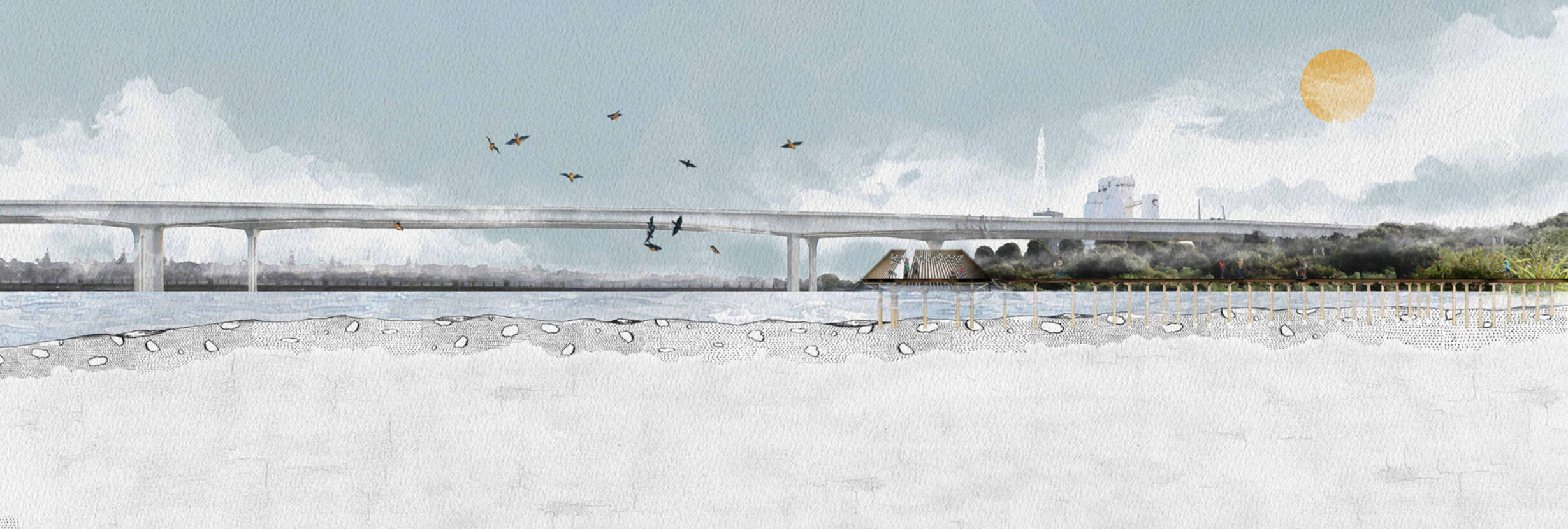
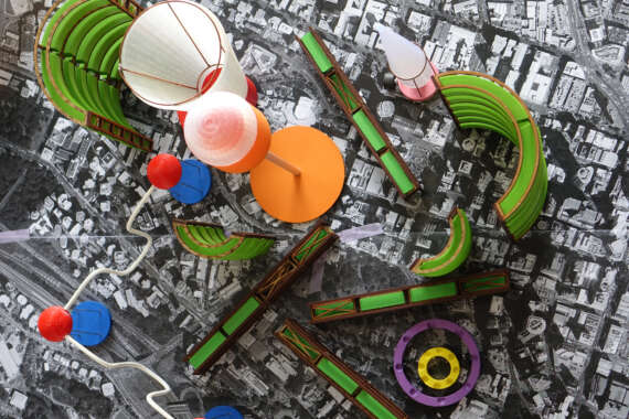
The edge of the Manukau Harbour is on the verge of becoming more industrialised by the current proposal of the East-West highway along the shoreline, which will further obliterate the few fragments left of the old shore: springs, streams and volcanic tuff crater. In the face of this disappearing natural landscape and desecrated identity, I want to find ways to restore the historic life essence and charm of Onehunga.

This thesis searches for the mauri of the underlying landscapes at Bycroft Springs, Captain Springs, The Grotto, The Pond, Gloucester Park and the Manukau Foreshore Walkway. These sites retain fragments of the historical landscape and aquifers. Time gives the landscape a vertical dimension; quarrying into the earth is like going back into the past.

How can this geological feature, with its strong associations of mauri to the Māori people, be brought back to the surface and the present? How can I, through architectural interventions, expose the natural springs, and the uncanny but sublime narratives of Onehunga and the Manukau Harbour?

This thesis aims to explore new ideas of marking, recognition and ritual between the unusual forgotten underground and the current manufactured landscape. It proposes the research question: How can architectural interventions be used to reinstate a historical knowledge of Onehunga's aquifers and subterranean landscape into a heavily industrialised setting?

 
Map Directory With Models
Map directory

The following six architectural interventions aim to reinstate a historical knowledge of Onehunga’s aquifers and/or subterranean landscapes into a heavily industrialised setting.

Each site with its unique geological feature will primarily address its immediate underlying mauri. The outcomes will include strong associations of mauri to the Māori through the insertion of the four core Māori values: manaakitanga, mātauranga, wairuatanga and kaitiakitanga.

The interventions range from the poetic to the utilitarian. However, they will collectively share similar formal qualities of marking, recognition and ritual in the varies dilapidated sites.


THE WATER FOUNTAIN TOWER

The Water Fountain Tower celebrates life, the spring water, flora and the invisible spirits of the Bycroft Springs. In developing the Water Fountain Tower, I wanted to explore how to signal the forgotten underground springs and reservoir currently constricted by the NZTA bus depot and tucked behind the train tracks across from the pumping station (currently providing 5% of Auckland’s drinking water). I felt it was important to see the marker from afar and be able to look out from the massively constrained site.

This tower is to be first and foremost a marker in the overall industrial landscape, signalling the original 1700 shoreline. The tower taps into the underground spring water pipes coming from the pumping station and diverts water upwards into an internal shower where it then descends into an opening in the ground. During the descent, water can be collected and consumed, referencing the historic Māori stories of voyage to this place to fill their gourds with drinking water.

The cascading waters form vaporised spring water that trickle down the watercress modular panels concealed in an EFT skin over the metal grate platform. These components are carefully selected to maximise the illusion of the historic watery landscape.

Bycroft Render
View of The Water Fountain Tower
Bycroft Section
Section of The Water Fountain Tower at Bycroft Springs

THE GEYSER

With the geyser I wanted to explore the subterranean world associated with the neglected underground springs and reservoir. These are found at the end of a single narrow driveway within a vast public reserve behind industrial warehouses for Steelpipe, New Zealand. I felt the disperse site needed a marker to signal the historic bubbling landmark.

The geyser becomes a landmark that rejoices in the hidden watery underground world and mauri of Captain Springs. Buried into the ground by four metres, with only three metres showing above ground, the geyser is a lure for gatherings, interaction and drama. People can enter down into the dark damp cavern. Spring water is held back until pressure builds up and released in a geyser blast. 

Captain Render
View of The Geyser
Captain Section
Section of The Geyser at Captain Springs

THE WALKWAY

The Grotto is private and entirely hidden by suburbia. I wanted to continue with the secrecy of revealing, not quite touching the land forms of the collapsed lava caves.

The Walkway inserts itself behind a suburban Skyline garage containing an artificial recreation of the lava caves. The recreation aims to reference the historic Grotto caves that hold the spirits and bodies of Māori ancestors. Exiting the garage, you transition into a metal staircase nestled into the earth to be welcomed by the arrival of a metal horseshoe-shaped walkway.

The Walkway terminates standing over the glass balustrade placing you in alignment to the historic entrance of the potential lava caves.

The Walkway Render
View of The Walkway

FLOATING BUBBLES

After decades of excavation for diatomite (an early cleaner/soap ingredient), the Pond is now a public open-water pond and nature reserve in the middle of a suburban setting. The proposed Floating Bubbles is a playful metaphor that references the historical diatomite quarry activity. The three floating ‘bubble’ shapes allow people to get out on the water, to sit, mediate or lounge about. They aim to be a calm and tranquil oasis amongst the suburban setting.

The Pond Render
View of the Floating Bubbles
The Grotto And Pond
Section of The Walkway at the Grotto and Floating Bubbles at the Pond

TUFF CRATER RING

The Tuff Crater Ring needed to address a much greater scale of geological form and physical disconnection. It needs to highlight the underlying original landscape of the tuff crater ring and historical narratives.

The 300-metre diameter steel pedestrian and bicycle bridge hovers over the eight-lane motorway, outlining the circular tuff ring crater. Connections between Onehunga town centre train station and the waterfront are now possible.

The ‘split’ opening form of the bridge is a practical design response to its historic and current context - a subtle notation to allude to the historic 1700 opening into the basin. The western exit connects the tip of Mangere Bridge and the eastern exit connects to the dedicated pedestrian cycle linking to Onehunga reclaimed beach.

The Ring is a vessel that carries the stories of the place. The intangible history and mauri of this place are acknowledged along a series of outer panels. The Ring becomes a layered experience with the panels progressively revealing the layers of Māori and European history. The panels are balanced out with clear glass panes to juxtapose the displayed stories with the existing context.

Built into the inner panels facing outwards is a multimedia screen providing further insight into the history and mauri of the site. The shifting inclination of the screen enables a dynamic viewing experience for the travellers below. By night the Ring continues to translate these stories with illuminated panels. Demonstrated by Lisa Reihana’s 'In Pursuit of Venice', the moving projection recognises the stories, history and beauty of Onehunga. 

Gloucester Night Render
Night view of the Tuff Crater Ring
Tuff Crater Ring Section
Section of the Tuff Crater Ring at Gloucester Park

PURE PODIUM

The Pure Podium allows people to experience the ancient Māori Pure (pu- ré) ritual of cleansing negativity through harnessing the tidal energy of the Manukau Harbour. The Pure Podium reinstates a ceremonial theatre to practice a traditional Māori ritual of letting go to all stresses and negativity.

The three-metre tidal change in water level activates a slowly changing spatial experience. At high tide the cedar poles float up to form an enclosed space creating an inward focus. With the water so close, people can place a leaf into the water as a physical symbolism of letting go their stresses and negativity. As the tide goes out the timber poles slide back down to the mudflats opening the Podium to the expanse of mudflats and horizon. I wanted the structure to breathe in and out with the tide.

Pure Render
View of the Pure Podium at high tide
Pure Section
Section of the Pure Podium at Manukau Foreshore
Large Models
Models of the six architectural propositions